Blog

  • Daily Tech Blitz – Slot 5: How Raleigh-Durham Is Shaping the Future of Satellite Imagery

    Daily Tech Blitz – Slot 5: How Raleigh-Durham Is Shaping the Future of Satellite Imagery

    Raleigh-Durham is becoming a serious center for the next generation of satellite imagery.

    The region’s universities, startups, and engineering companies are working on technology that could make Earth observation faster, more reliable, and more useful in everyday decisions: from monitoring energy infrastructure to responding to storms.

    For homeowners, this progress is already practical. Satellite-powered tools can measure a roof, estimate replacement costs, and help people plan a major project without waiting days for a contractor visit.

    The next wave of satellite technology could make those measurements even more frequent and reliable.

    The 2026 satellite technology update from Durham

    The most significant recent development is Extellis, a Durham-based startup founded from Duke University research.

    In July 2026, Extellis announced that Shell Ventures joined its seed round. The company has raised more than $7 million when combined with earlier investment and non-dilutive funding, including support connected to DARPA and Duke Capital Partners.

    Its goal is to change how synthetic aperture radar, or SAR, satellites collect images.

    What is SAR?

    Traditional satellite cameras generally use visible or infrared light. That creates limitations:

    • Clouds can block the view.
    • Darkness prevents normal photography.
    • Smoke, storms, and poor weather can create coverage gaps.

    SAR uses radar signals instead. The satellite sends signals toward the ground and measures the returning reflections. Because radar does not depend on sunlight, SAR can capture imagery at night and in many cloudy conditions.

    A simple comparison:

    • Optical imagery: Similar to taking a photograph with a camera.
    • SAR imagery: Similar to using radar to map the shape and surface of an area, even when a normal camera cannot see clearly.

    That makes SAR valuable for agriculture, shipping, disaster response, pipeline monitoring, and infrastructure management.

    Extellis is using metamaterials to increase capacity

    The key Extellis innovation is its metasurface antenna.

    Metamaterials are engineered structures designed to control electromagnetic waves in ways that ordinary materials cannot. In Extellis’ system, the antenna is designed to steer radar beams electronically across wide areas without relying on a large, mechanically moving dish.

    In practical terms, that can mean:

    • A lighter satellite payload
    • Lower power requirements
    • Faster beam steering
    • Lower manufacturing costs
    • More images collected per satellite

    Current SAR systems may capture hundreds of images per day. Extellis says its technology is designed to collect up to 10,000 images per day.

    That is not a minor improvement. It could make satellite imagery a high-volume service rather than an occasional, expensive resource.

    Extellis metasurface antenna and satellite imaging technology

    The Pathfinder mission is the next test

    Extellis is developing its first orbital demonstration, known as the Pathfinder mission.

    The mission is expected to test the antenna technology in space and establish the systems needed for commercial satellite imagery. Based on the company’s current development timeline, the satellite is expected to launch by the end of 2027.

    That mission matters because laboratory performance is only the first step. The company must also demonstrate that its system can:

    1. Operate reliably in orbit.
    2. Capture useful images at scale.
    3. Transfer data efficiently to ground stations.
    4. Deliver consistent coverage to commercial customers.
    5. Support time-sensitive applications.

    If successful, the Pathfinder mission could help move high-frequency SAR from a specialized government and industrial tool into a more broadly available data service.

    Extellis identifies potential applications in:

    • Precision agriculture
    • Energy infrastructure monitoring
    • Disaster response
    • Shipping and logistics
    • Pipeline and utility management
    • Insurance monitoring
    • Route planning

    The company’s technical approach explains how its antenna is designed to provide all-weather, day-and-night visibility at industrial scale.

    NC State and Axiro are advancing satellite connectivity

    Extellis is not the only Triangle-area effort worth watching.

    Researchers at NC State’s Integrated Communication and Sensing Lab are collaborating with Axiro Semiconductor on next-generation phased-array systems and integrated sensing and communications, or ISAC.

    A phased array uses multiple small antenna elements working together. By coordinating those elements electronically, the system can steer signals without physically moving the antenna.

    ISAC takes the concept further by combining:

    • Wireless communication
    • Environmental sensing
    • RF imaging
    • Data transmission

    Instead of using separate systems for communication and sensing, an ISAC platform can perform both functions through a shared architecture.

    The NC State–Axiro work is focused on FR2 and FR3 frequency platforms relevant to advanced wireless networks, future 6G systems, and satellite communications. Their research also includes an AI-enabled digital twin framework capable of supporting sensing, wireless transmission, and RF imaging on the same testbed.

    The practical implication is important: future satellite networks may not only transmit data. They may also sense conditions, interpret environments, and adapt their communications in real time.

    Read the NC State and Axiro collaboration announcement for additional technical details.

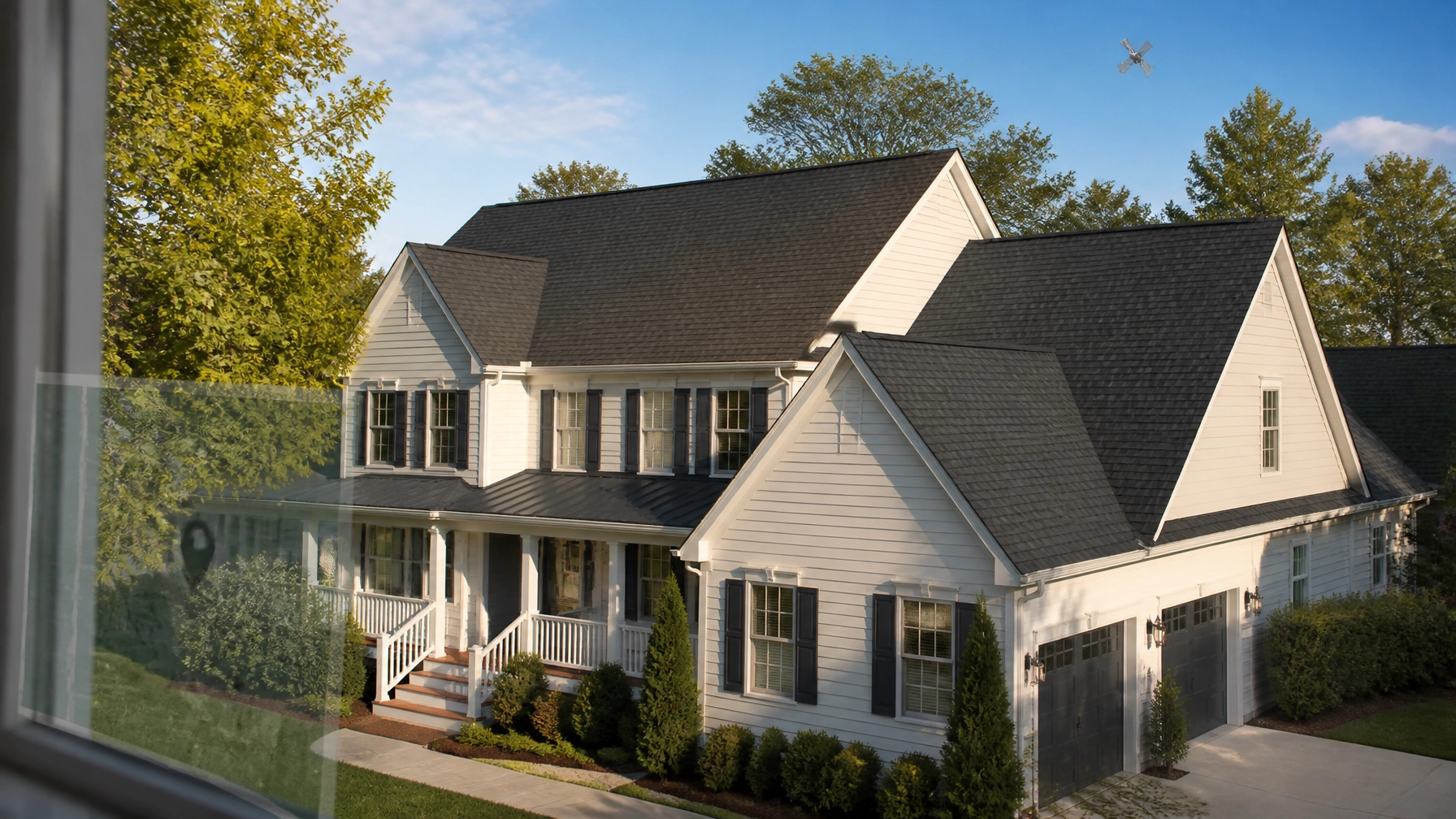
    New Raleigh-area home with a standing-seam metal roof

    What this means for homeowners in Raleigh

    Most homeowners do not need to understand antenna design to benefit from satellite innovation.

    The value is in the services built on top of it.

    Today, satellite imagery roof analysis can help estimate:

    • Roof area
    • Roof sections and facets
    • Approximate pitch
    • Roof complexity
    • Material quantities
    • Replacement cost ranges

    For a typical U.S. roof in 2026, replacement costs commonly fall between $9,000 and $22,000, although Raleigh pricing depends on roof size, material, pitch, labor, and project complexity. Larger or more complex homes can reach $25,000 or more.

    Common material benchmarks include:

    • Architectural shingles (Popular): Approximately $9,000–$13,000 for a 2,000-square-foot roof
    • Metal roofing (Premium): Approximately $20,000–$28,000
    • Roof coatings (Budget for suitable roofs): Approximately $6,000–$7,500

    These are planning ranges, not final contractor bids.

    Tools such as RoofVista report approximately 95%–98% area accuracy for many standard residential roof designs. However, accuracy can vary when trees, shadows, poor image quality, unusual rooflines, or additions block the roof surface.

    Satellite measurement is not a complete roof inspection

    This distinction is essential.

    A satellite roof inspection: or more accurately, a satellite roof measurement: can help determine the roof’s geometry and replacement budget. It cannot confirm every physical condition on the property.

    Satellite imagery generally cannot verify:

    • Hidden decking damage
    • Active leaks
    • Flashing condition
    • Attic ventilation
    • Fastener installation
    • Structural deterioration
    • Interior water damage
    • Building-code requirements

    After a storm, Raleigh homeowners may use satellite measurement for an initial estimate, then arrange a drone or on-site inspection. Local providers such as StormSafe, Skybird, and Drone Studio NC offer aerial inspection services, but homeowners should ask what each inspection includes and whether a licensed roofing professional will verify the findings.

    The strongest process combines three layers:

    1. Satellite measurement: Fast roof geometry and budget planning.
    2. Drone imagery: Close-range documentation of visible surfaces.
    3. On-site inspection: Confirmation of damage, leaks, decking, flashing, and code requirements.

    Aerial view of a newly installed dimensional shingle roof in Raleigh

    Get a satellite-powered roof estimate in 60 seconds

    This is the same direction that guides Get My Roof Estimate Now.

    Our service uses satellite imagery technology to measure a home’s roof and estimate replacement costs without requiring an upfront contractor visit. Homeowners enter their address and receive a free estimate in about 60 seconds.

    The system evaluates:

    • Roof size, measured in squares
    • Pitch and slope
    • Roof complexity
    • Regional labor and material pricing
    • Different roofing materials
    • Low, middle, and high price ranges

    The estimate is free, with no credit card required and no obligation to hire a contractor.

    You can start a free satellite-powered roof estimate or review the 2026 roof cost calculator before speaking with local professionals.

    The future of roof inspection is layered technology

    Raleigh-Durham’s satellite industry shows where the broader market is heading.

    Extellis is working to make radar imagery more frequent and dependable. NC State and Axiro are developing systems that combine communication and sensing. Roofing platforms are already using satellite data to measure homes and produce fast replacement estimates.

    The future of roof inspection will not depend on one technology alone.

    It will combine:

    • High-volume satellite imagery
    • AI-based roof analysis
    • Drone documentation
    • Local weather and storm data
    • Professional human verification

    For homeowners, the result should be simple: better information, faster decisions, and fewer surprises before a roof project begins.

    Newly replaced roof on a Southern colonial home after storm season

    Sources and further reading

  • 2026 Roof Replacement Cost in Detroit, MI: Complete Price Guide for Motor City Homeowners

    2026 Roof Replacement Cost in Detroit, MI: Complete Price Guide for Motor City Homeowners

    Detroit homeowners should budget $12,407–$16,786 for a standard architectural-shingle roof replacement in 2026. That range reflects a typical Detroit-area roof, current material costs, local labor, tear-off, and standard installation conditions.

    For comparison, the average Detroit roof measures approximately 2,327 square feet. Local planning benchmarks are about $4.50 per square foot for asphalt roofing and $8.75 per square foot for metal roofing. Final pricing depends on roof pitch, complexity, decking condition, permits, and material grade.

    This guide explains what Motor City homeowners should expect to pay and how to get a faster, more accurate starting estimate.

    Detroit Roof Replacement Costs at a Glance

    Cost factor 2026 Detroit benchmark
    Average roof size 2,327 sq. ft.
    Architectural shingle replacement $12,407–$16,786
    Asphalt planning rate About $4.50/sq. ft.
    Metal planning rate About $8.75/sq. ft.
    Average roofing labor rate About $57 per hour
    Typical Wayne County permit fee Approximately $146
    Average hail days 2.5 per year
    2026 expected price increase 6%–8%

    The 2026 increase reflects supply chain pressure, labor shortages, and asphalt costs that have risen approximately 12%–18% since 2023.

    Cost by Detroit Home Size

    Architectural shingles remain the standard choice for Detroit homes. Approximately 90% of local homes use architectural shingles, largely because they balance appearance, durability, and cost.

    Detroit home type Approximate roof size 2026 replacement range
    Small ranch 1,500 sq. ft. $9,500–$14,500
    Average colonial 2,000–2,500 sq. ft. $13,500–$20,500
    Larger two-story home 2,800–3,200 sq. ft. $18,500–$28,000

    These are planning ranges, not binding quotes. A home with several roof planes, dormers, valleys, or steep sections can cost more than a simple ranch with the same living area.

    Detroit Roofing Material Costs

    3-Tab Asphalt Shingles (Budget)

    • Planning rate: about $4.50 per sq. ft.
    • Expected lifespan: 15–20 years
    • Best for: Cost-conscious homeowners and basic rental-property improvements

    Three-tab shingles are the least expensive option, but they have a shorter service life and a flatter appearance. They may not provide the best long-term value in Detroit’s freeze-thaw climate.

    Architectural Shingles (Popular)

    • Typical cost: 1.2–1.5 times the asphalt baseline
    • Approximate planning range: $5.40–$6.75 per sq. ft.
    • Expected lifespan: 25–30 years
    • Best for: Most Detroit single-family homes

    Architectural shingles are thicker, more dimensional, and better suited to homeowners who want a balance of curb appeal and durability. They are the most common replacement material in the Detroit area.

    Metal Roofing (Premium)

    • Planning benchmark: about $8.75 per sq. ft.
    • Typical multiplier: 1.8–2.5 times asphalt
    • Expected lifespan: 40–70 years
    • Best for: Long-term ownership and enhanced weather resistance

    Metal roofing costs more upfront but can provide decades of service. It also sheds snow effectively when properly designed and installed. Standing-seam systems typically cost more than exposed-fastener panels.

    Detroit ranch home with a newly installed architectural shingle roof

    Class 4 Impact-Resistant Shingles (Upgrade)

    Expect to add approximately $1,500–$3,500 for Class 4 impact-resistant shingles, depending on roof size and product.

    Detroit averages about 2.5 hail days per year, and spring storms can produce insurance claims throughout Wayne County. Impact-resistant shingles may help reduce future damage and could qualify for an insurance premium discount. Confirm eligibility with your carrier before selecting the upgrade.

    Why Detroit Roof Prices Vary

    Roof Deck Replacement

    Detroit has an aging housing stock. During tear-off, contractors may find rotted, water-damaged, or structurally weak decking beneath the shingles.

    Deck replacement is usually priced separately. Ask each contractor for:

    • The price per sheet of replacement decking
    • Whether damaged rafters or trusses are included
    • A written change-order process
    • Photos of any concealed damage

    A low initial bid can increase significantly if it does not clearly explain how deck repairs are handled.

    Ice and Water Protection

    Ice and water shield is essential for Detroit roofs. Cold winters, snow accumulation, and repeated freeze-thaw cycles create conditions for ice dams.

    An ice dam forms when attic heat melts snow higher on the roof, while the colder eaves refreeze the runoff. Water can then back up beneath shingles and enter the attic or walls.

    The City of Detroit’s ice dam guidance recommends addressing heat loss, ventilation, and drainage: not simply removing ice after it forms.

    A complete Detroit roofing system should typically include:

    • Ice and water shield at eaves and valleys
    • Proper underlayment
    • Balanced soffit and ridge ventilation
    • Correct flashing around chimneys and walls
    • Clean, functional gutters and downspouts

    Roof Pitch and Complexity

    A steep or complex roof requires more safety equipment, labor, and time. Dormers, skylights, multiple valleys, and difficult access can increase the price even when the roof area is average.

    Permits and Local Requirements

    A typical Wayne County permit fee is approximately $146, although the final amount can vary by municipality and project scope. Detroit, Dearborn, Livonia, and other Wayne County communities may use different fee schedules.

    Ask the contractor:

    • Who will pull the permit?
    • Is the fee included in the proposal?
    • What inspections are required?
    • Will the permit be closed after final inspection?

    Michigan residential roofing contractors must meet licensing requirements through the Michigan Department of Licensing and Regulatory Affairs (LARA). Verify the contractor’s license, general liability coverage, and workers’ compensation insurance before signing.

    Historic districts may also have specific requirements for roofing materials, colors, or visible architectural details.

    Winter-ready architectural shingle roof on a Detroit colonial home

    How Satellite Technology Changes Detroit Roof Estimates

    Traditional estimates often require several contractor visits before a homeowner receives useful pricing. A modern satellite roof inspection provides a faster starting point.

    With satellite technology roofing tools, an address can be analyzed for:

    • Roof size and measurements
    • Roof pitch
    • Number of roof planes
    • Valleys, ridges, and complexity
    • Estimated material quantities
    • Local pricing ranges

    Our satellite imagery roof analysis measures most properties to approximately 90%–95% accuracy and produces low, middle, and high replacement ranges. It is useful for budgeting, comparing contractor proposals, and deciding whether a full inspection is worthwhile.

    However, satellite analysis has limits. An overhead roof inspection satellite report cannot reliably identify hidden deck rot, interior leaks, flashing defects, or small hail bruises. AI roof damage detection and other roofing technology in 2026 are best used for measurement and initial screening. A licensed contractor or insurance adjuster should confirm final damage and scope.

    You can use the Get My Roof Estimate Now calculator for a general planning range, or enter your Detroit address to receive a free satellite-based estimate in about 60 seconds.
    Best Time to Replace a Roof in Detroit

    The best replacement window is generally May through September. These months provide more reliable temperatures, longer daylight, and better conditions for shingle sealing.

    Winter work is possible in an emergency, but cold weather can create installation delays and prevent asphalt shingles from sealing immediately. Some contractors offer 5%–10% off-season discounts between late fall and winter, but confirm how weather delays and warranty requirements are handled.

    Plan early. Detroit roofing demand rises after spring hailstorms and before the first major winter snow.

    How to Compare Detroit Roofing Estimates

    Get at least three written proposals. Each should specify:

    • Roof measurement in squares
    • Material brand, type, and color
    • Tear-off and disposal costs
    • Ice and water shield locations
    • Ventilation work
    • Deck replacement pricing
    • Permit responsibility
    • Workmanship warranty
    • Start and completion expectations

    Avoid contractors who demand full payment upfront, refuse to provide license information, or pressure you to sign immediately after a storm.

    Wayne County recorded approximately 11,248 permits last year, and the Detroit area has about 112 active roofing contractors. That gives homeowners options: but it also makes written comparisons important.

    Get a Detroit Roof Estimate in 60 Seconds

    Before scheduling multiple contractor visits, find out what your roof may cost. Get a free, no-credit-card estimate based on your actual roof size, pitch, complexity, material selection, and Detroit-area pricing.

    Start your free satellite roof estimate

    Frequently Asked Questions

    How much does a new roof cost in Detroit in 2026?

    A standard architectural-shingle replacement typically costs $12,407–$16,786 for an average Detroit-area home. Larger or more complex roofs can reach $20,000–$28,000 or more.

    Is metal roofing worth the extra cost in Detroit?

    Metal roofing can make sense for homeowners planning to stay in the property for decades. It costs more initially: about $8.75 per square foot as a local planning benchmark: but may last 40–70 years.

    Does satellite imagery detect roof damage?

    Satellite and aerial imagery can identify roof size, pitch, major visible damage, and condition signals. It cannot confirm hidden leaks, decking rot, or every small hail impact. Use it as a fast planning tool, then obtain a professional inspection for final scope.

    When should Detroit homeowners replace their roofs?

    May through September is usually the most practical period. Start estimating several weeks or months ahead, especially if the roof is more than 20 years old or has storm damage.

  • Daily Tech Blitz – Slot 7: Nashville’s Satellite Tech Edge Is Rewiring Music City From Space

    Daily Tech Blitz – Slot 7: Nashville’s Satellite Tech Edge Is Rewiring Music City From Space

    Nashville’s next technology layer is not confined to server rooms, traffic centers, or fiber routes. It is orbiting hundreds of miles above the city.

    Satellite systems are now supporting rural broadband, mapping Nashville’s physical growth, and helping researchers build real-time digital models of traffic movement. Together, these systems are creating a more connected and measurable version of Music City.

    The timing matters. Nashville-Davidson’s certified 2026 population is 548,081, according to the Tennessee Department of Economic and Community Development’s certified population report. More residents, new construction, expanding suburbs, and heavier traffic require better data.

    Nashville’s satellite technology edge is developing across three major fronts:

    • Low-Earth-orbit broadband for unserved rural areas
    • Satellite and aerial mapping for urban planning
    • LiDAR-powered digital twins for traffic management

    1. Tennessee’s $813 Million Broadband Program Looks to Orbit

    Tennessee has a total BEAD allocation of approximately $813 million through the federal Broadband Equity, Access, and Deployment program.

    The state’s current deployment plan combines fiber, cable, and low-Earth-orbit satellite systems. In March 2026, Tennessee announced more than $202 million in BEAD awards for 128 projects across 74 counties. The projects are designed to reach more than 43,000 previously unserved or underserved locations, with approximately $200 million in matching funds.

    The state expects funded projects to be completed by December 2028. The Tennessee broadband announcement lists the satellite awards alongside fiber and telecommunications projects.

    Starlink and Project Kuiper awards

    Two awards stand out:

    • Space Exploration Technologies Corp. : $1,272,500
    • Amazon Leo, representing Project Kuiper : $2,440,400

    These awards will support service in rural areas across multiple Tennessee counties. The locations include communities in and around Middle Tennessee, including parts of Rutherford, Williamson, Maury, Wilson, Lewis, and other counties connected to Nashville’s broader economic region.

    The practical advantage of satellite broadband is deployment speed. Fiber remains the preferred solution in many areas because it offers strong capacity and long-term performance. However, laying fiber across steep terrain, wooded areas, or widely dispersed rural properties can be expensive and slow.

    LEO satellite systems offer a different model:

    • Faster coverage deployment across dispersed locations
    • Less dependence on new ground-based cable routes
    • Connectivity for homes, farms, businesses, and remote facilities
    • Potential backhaul for roadside sensors and rural infrastructure

    This does not mean satellite replaces fiber. Tennessee’s technology-neutral BEAD structure treats satellite as a complement for locations where a full fiber buildout may not be practical.

    For Nashville, the regional impact could be significant. Rural communities outside the urban core are connected to the city through employment, logistics, education, healthcare, and transportation. Better broadband can reduce unnecessary travel, support remote work, and provide connectivity for sensors along roads and freight routes feeding the metro area.

    2. Metro GIS Turns Nashville Into a Mappable System

    Broadband is only one part of the satellite story. Nashville also depends on high-quality geospatial data to understand how the city is changing.

    Metro Nashville’s Mapping Services and GIS division maintains parcel data, zoning maps, topographic information, aerial maps, and digital geographic datasets for Davidson County.

    This information supports decisions about:

    • New residential and commercial development
    • Floodplains and drainage
    • Road and utility planning
    • Property boundaries
    • Land-use changes
    • Infrastructure investment
    • Tree canopy and environmental conditions

    Orthoimagery provides the visual baseline

    Orthoimagery is aerial imagery corrected for distortion and aligned to real-world coordinates. Unlike a standard photograph, an orthophoto can be used as a reliable mapping layer.

    Planners can compare imagery over time to identify:

    • New buildings
    • Demolished structures
    • Road expansions
    • Parking changes
    • Construction activity
    • Changes in open space
    • Development near transportation corridors

    Satellite imagery adds another level of coverage. It may not always provide the same detail as municipal aerial photography, but it offers consistent, repeatable observations across large areas.

    That makes it useful for detecting regional development patterns, especially where construction is moving quickly beyond traditional urban boundaries.

    LiDAR adds the third dimension

    LiDAR uses laser pulses to measure elevation and physical structure. The result is a three-dimensional point cloud that can describe buildings, roads, bridges, vegetation, and terrain.

    Nashville’s official mapping environment includes LiDAR-derived elevation data. The city’s topographic contour service, for example, includes contours derived from 2022 LiDAR data with a two-foot interval.

    That level of detail supports more than visualization. It can help planners analyze:

    • Road grades
    • Drainage routes
    • Flood exposure
    • Bridge and roadway clearances
    • Tree canopy height
    • Construction feasibility
    • Visibility and line-of-sight conditions

    Nashville urban planning GIS workspace displaying aerial imagery, parcel boundaries, contours, and LiDAR elevation data

    3. Vanderbilt and NDOT Are Building a Traffic Digital Twin

    Nashville’s most advanced satellite-adjacent application may be the creation of a living digital model of the city’s transportation system.

    Vanderbilt researchers Aniruddha Gokhale and Yogesh Barve are developing “LiDAR Data-Driven Digital Twins for Real-Time Traffic Congestion Control” in partnership with the Nashville Department of Transportation and Multimodal Infrastructure.

    The project received a Civic Tech Jam award through the Nashville Innovation Alliance. According to Vanderbilt’s announcement, the work will combine digital twin modeling with LiDAR technology to create detailed, real-time representations of traffic systems.

    What the digital twin can measure

    LiDAR sensors can detect and track movement without relying solely on traditional cameras. Depending on the deployment, the system can identify patterns involving:

    • Vehicles
    • Pedestrians
    • Cyclists
    • Lane movement
    • Queues and bottlenecks
    • Intersection activity
    • Near-miss safety events

    Those observations can feed a dynamic 3D model of Nashville’s streets. The model is not simply a static map. It is designed to represent how the transportation system behaves over time.

    NDOT could use the resulting data to evaluate:

    • Signal timing
    • Lane configurations
    • Road closures
    • Event traffic
    • Pedestrian safety
    • Transit movement
    • Emergency routing

    The project supports NDOT’s “Choose How You Move” initiative by giving transportation planners more responsive, evidence-based tools.

    LiDAR sensors and a real-time 3D digital twin visualization of traffic in downtown Nashville

    4. The Urban Pulse Framework Tracks Neighborhood Change

    Urban Pulse adds a longer-term view to Nashville’s fast-moving development cycle.

    The framework uses dense time-series satellite data, including combined Landsat and Sentinel-2 observations, to measure how neighborhoods physically change over time. Instead of relying on a single image, it analyzes repeated observations to identify trends.

    Urban Pulse-style analytics can detect:

    • New construction
    • Demolition
    • Infrastructure upgrades
    • Expansion into green space
    • Changes in impervious surfaces
    • Neighborhood-level development intensity

    The concept has been demonstrated across multiple global cities, but public information does not establish that Nashville currently operates an official Urban Pulse deployment. The framework is better understood as a powerful method that could complement Nashville’s existing GIS, planning, and transportation systems.

    For Nashville, an Urban Pulse implementation could connect satellite observations with:

    • Metro parcel and zoning layers
    • Building permits
    • NDOT project maps
    • Crash and safety data
    • Traffic sensor feeds
    • LiDAR elevation models
    • Neighborhood boundaries

    That combination would help answer questions that individual datasets cannot resolve.

    For example:

    • Is congestion increasing because of a new residential cluster?
    • Did a major road project change development patterns nearby?
    • Which neighborhoods are losing green space fastest?
    • Are new construction areas adequately connected to existing roads?
    • Where are physical changes occurring before official records are updated?

    Satellite time-series visualization showing neighborhood development, roads, green space, and construction changes around Nashville

    Nashville’s Satellite Future Is an Integrated Data Stack

    The important shift is not one satellite, one sensor, or one grant. It is the integration of multiple data layers.

    Tennessee’s BEAD program expands connectivity into rural areas. Metro GIS provides the geographic foundation. Orthoimagery shows how land is changing. LiDAR adds elevation and structure. Vanderbilt’s digital twin research turns movement data into a live transportation model. Urban Pulse contributes a repeated, citywide view of development.

    Together, these technologies allow Nashville to operate with greater visibility.

    The city can observe its physical environment from above, measure structure in three dimensions, monitor movement in real time, and compare neighborhood change across months or years.

    That is the real satellite technology edge: not just seeing Nashville from space, but using orbital and spatial data to make faster, more precise decisions on the ground.

    Sources

  • Insurance Masterclass: How Albuquerque NM Homeowners Can Get Their Roof Replacement Covered in 2026

    Insurance Masterclass: How Albuquerque NM Homeowners Can Get Their Roof Replacement Covered in 2026

    A hail-damaged roof may qualify for insurance coverage in Albuquerque, but approval depends on your policy, the storm damage, your deductible, and the quality of your documentation.

    For 2026, most U.S. homeowners should plan on approximately $8,000–$25,000 for a complete roof replacement. Asphalt shingles commonly fall near the lower end, while metal, synthetic, concrete tile, and clay tile can cost substantially more. Use our free satellite roof estimate to measure your Albuquerque property and see a low-middle-high price range in about 60 seconds, before deciding whether to file a claim.

    This guide explains how Albuquerque homeowners in ZIP codes 87101 through 87199 can evaluate damage, document a claim, and avoid common insurance mistakes.

    Does New Mexico Homeowners Insurance Cover Hail Damage?

    According to the New Mexico Office of the Superintendent of Insurance (OSI), most standard homeowners policies cover hail damage to roofs and other parts of the home.

    However, coverage is not automatic. Your policy may include:

    • A separate wind or hail deductible
    • Cosmetic damage exclusions
    • Actual cash value coverage instead of replacement cost coverage
    • Roof-age limitations
    • Wear-and-tear exclusions
    • Requirements to report damage promptly
    • Limits on matching materials or replacing undamaged roof sections

    The key distinction is sudden storm damage versus gradual deterioration.

    Hail impacts from a specific storm may be covered. Sun damage, aging shingles, cracking from thermal cycling, and poor maintenance are typically treated differently. In Albuquerque’s high-desert climate, these causes often overlap, which makes detailed documentation especially important.

    Close-up of hail impact damage and granule loss on asphalt shingles typical of an Albuquerque roof

    Albuquerque’s Climate Creates Two Different Roofing Problems

    Albuquerque roofs face year-round UV exposure and periodic severe weather.

    High-desert sun damage (Long-term wear)

    Albuquerque receives intense sunlight, low humidity, and large temperature swings. Over time, this can cause:

    • Brittle or curling shingles
    • Granule loss
    • Deteriorated sealants
    • Cracked flashing
    • Membrane aging on low-slope roofs
    • Expansion and contraction around roof penetrations

    Sun damage alone is usually not a covered insurance event. However, hail can remove protective granules and expose already weathered shingles. Your insurer may separate the storm-related damage from pre-existing deterioration.

    Monsoon and hail damage (Sudden loss)

    The National Weather Service identifies the North American Monsoon as a major source of summer thunderstorms in New Mexico. In the central Rio Grande Valley, including Albuquerque, monsoon activity commonly develops around early July, with bursts of heavy rain, strong winds, lightning, and occasional hail.

    These storms can damage:

    • Asphalt shingles
    • Tile and individual tile edges
    • Metal roof panels
    • Flashing around vents and chimneys
    • Gutters and downspouts
    • Skylights
    • Roof coatings and flat-roof membranes

    Review the NWS Albuquerque monsoon information when planning inspections before or after the storm season.

    Step 1: Confirm Your Policy Before Filing

    Find the declarations page and the roof-related sections of your policy. Look for these terms:

    Wind and hail deductible

    Some policies use a separate deductible for wind or hail. It may be a fixed amount or a percentage of your dwelling coverage.

    For example, if your dwelling coverage is $300,000 and your wind/hail deductible is 2%, your deductible would be $6,000. That amount can materially change whether filing a claim makes financial sense.

    Replacement cost value (RCV)

    RCV coverage generally pays the cost to replace covered damage with comparable materials, subject to your deductible and policy limits. Some policies pay an initial depreciated amount and release the remaining replacement-cost payment after repairs are completed.

    Actual cash value (ACV)

    ACV coverage subtracts depreciation based on age and condition. An older, heavily sun-worn roof may receive a substantially lower payment under ACV terms.

    Roof exclusions and limitations

    Check for exclusions involving:

    • Wear and tear
    • Deterioration
    • Neglect
    • Cosmetic damage
    • Roofs above a specified age
    • Prior unrepaired damage
    • Improper installation

    If the wording is unclear, ask your insurance agent for an explanation in writing.

    Step 2: Get a Property-Specific Roof Measurement

    Before filing, establish the approximate size and complexity of your roof. This gives you a realistic replacement benchmark and helps you evaluate whether an insurance estimate is complete.

    Traditional roof measurements may require an initial contractor visit. A satellite-based estimate gives you a fast planning baseline without putting anyone on the roof.

    Satellite roof measurement interface showing roof planes, dimensions, and measurement lines on a Southwestern home

    With Get My Roof Estimate Now, you enter your address and the system analyzes satellite imagery to estimate:

    • Roof size in square feet and roofing squares
    • Roof pitch
    • Roof sections and complexity
    • Material quantities
    • Local pricing factors
    • Low, middle, and high replacement ranges

    The system is designed to be approximately 90%–95% accurate for typical property measurements, with results in under a minute. It is free, requires no credit card, and does not replace an in-person inspection.

    Use it as a budget and scope benchmark, not as proof that hail damage exists. A contractor or adjuster still needs to inspect the roof surface, flashing, decking, and interior areas.

    You can also compare broad material pricing with the 2026 roof cost calculator:

    • Architectural shingles (Popular): Approximately $4.50–$6.50 per square foot
    • Metal roofing (Premium): Approximately $10–$14 per square foot
    • Synthetic roofing (Premium): Approximately $8–$16 per square foot
    • Roof coatings (Budget for eligible low-slope systems): Approximately $3–$3.75 per square foot

    Actual Albuquerque pricing varies by roof access, tear-off requirements, pitch, materials, permits, and contractor availability.

    Step 3: Document the Damage Safely

    Do not climb onto a wet or steep roof after a monsoon storm. Start from the ground and document visible damage with dated photographs and video.

    Capture:

    • Missing, lifted, cracked, or bruised shingles
    • Circular impact marks and exposed matting
    • Broken or displaced tiles
    • Dents in metal flashing, vents, and gutters
    • Damaged skylights
    • Water stains on ceilings or walls
    • Attic leaks or damp insulation
    • Debris and fallen branches
    • Temporary repairs and related receipts

    Also document the condition of the roof before repairs begin. Do not discard damaged materials until your insurer or contractor confirms that inspection is complete.

    If a leak is active, take reasonable temporary steps to prevent additional damage. A tarp or emergency patch may be appropriate, but avoid permanent repairs before the claim inspection unless necessary for safety.

    Step 4: Decide Whether to File an Actual Claim

    New Mexico does not impose one universal reporting deadline for every property claim. Your policy controls the reporting requirement, and many policies require notice “promptly” or “as soon as practicable.”

    That means you should not wait months after a hailstorm if you suspect damage.

    The New Mexico OSI homeowners insurance guidance recommends understanding your responsibilities, exclusions, coverage limits, and deductibles before proceeding.

    When contacting your insurer, be precise:

    “I am reporting possible roof damage from a hail and wind event on [date]. Please provide the claim number, deductible, inspection process, and documentation requirements.”

    Keep a written log of:

    • Date and time of each call
    • Representative or adjuster name
    • Claim number
    • Inspection date
    • Documents submitted
    • Settlement explanations
    • Deadlines stated by the insurer

    New Mexico insurance rules generally require insurers to handle claims within a reasonable time and explain coverage decisions. If a claim is denied or limited, request the decision in writing and ask the insurer to identify the specific policy language used.

    Step 5: Attend the Adjuster’s Inspection

    Be present when the adjuster inspects the property. If possible, arrange for a qualified local roofing professional to attend as well.

    A complete inspection should consider:

    • All roof slopes
    • Valleys and roof edges
    • Flashing and penetrations
    • Gutters and downspouts
    • Tile or shingle breakage
    • Interior water intrusion
    • The roof’s age and previous repairs
    • Whether damage is functional or cosmetic
    • Whether replacement materials are still available

    Do not assume that a few visible impact marks automatically qualify the entire roof for replacement. New Mexico generally does not require an insurer to replace undamaged sections simply because materials do not match. The policy, damage pattern, local requirements, and repair feasibility all matter.

    What If the Insurance Offer Is Too Low?

    Compare the insurer’s estimate with an itemized contractor estimate and your satellite measurement.

    Check for missing or understated items such as:

    • Tear-off and disposal
    • Underlayment
    • Ice and water protection where applicable
    • Flashing replacement
    • Drip edge
    • Ventilation
    • Permit costs
    • Decking repairs
    • Steep-slope labor
    • Code-required upgrades
    • Matching or discontinued materials

    If the offer does not appear complete:

    1. Request a written explanation.
    2. Ask for a reinspection.
    3. Submit dated photos and contractor documentation.
    4. Compare the deductible and depreciation calculations.
    5. Confirm whether the policy is ACV or RCV.
    6. Escalate through the insurer’s claims department.
    7. Contact the New Mexico OSI complaint assistance page if you believe the claim is being mishandled.

    A public adjuster or insurance attorney may also be appropriate for complex or disputed claims. Review fees carefully before signing an agreement.

    Use a Verified Albuquerque Contractor

    Once you understand the roof size, likely scope, and insurance position, obtain at least two or three written estimates. Get your initial pricing benchmark first, then use local contractors for an on-site evaluation.

    A reputable contractor should provide:

    • New Mexico licensing information where applicable
    • General liability insurance
    • Workers’ compensation coverage
    • A physical business address
    • Recent local references
    • An itemized scope of work
    • Material brands and specifications
    • Warranty terms
    • Payment schedule
    • Permit responsibilities

    Get My Roof Estimate Now can connect homeowners with verified, licensed, and insured local contractors in its network, subject to service availability in your area. There is no obligation to hire a contractor after receiving an estimate.

    Final Checklist for Albuquerque Homeowners

    Before filing a 2026 roof claim, complete these steps:

    • Review wind, hail, ACV, and RCV provisions.
    • Confirm your deductible.
    • Record the storm date and suspected damage.
    • Photograph the roof and interior areas safely.
    • Get a free satellite measurement for a replacement benchmark.
    • Report the loss according to your policy.
    • Attend the adjuster’s inspection.
    • Compare the settlement with an itemized local estimate.
    • Keep every receipt, email, photo, and inspection report.
    • Track policy deadlines, including any suit limitation period.

    A storm claim is easier to manage when you know the roof’s approximate size, material options, and replacement cost before the insurance process begins. Start with an instant, free satellite estimate for your Albuquerque property and make the next decision with better information.

    Get Your Free Roof Estimate in 60 Seconds

    This article is for general educational purposes and is not legal, insurance, or claims-adjusting advice. Your coverage depends on the wording of your policy and the facts of your loss. Contact your insurer, a licensed New Mexico insurance professional, or qualified legal counsel for advice about your specific claim.

  • Daily Tech Blitz – Slot 4: Knoxville’s Satellite Tech Edge Is Putting East Tennessee on the Map

    Daily Tech Blitz – Slot 4: Knoxville’s Satellite Tech Edge Is Putting East Tennessee on the Map

    For Knoxville homeowners, the next roof estimate may begin far above East Tennessee.

    Satellite imagery, artificial intelligence, high-performance computing, and advanced geospatial software are changing how homes and buildings are measured. Instead of waiting days for a contractor to visit just to provide a rough price, homeowners can now receive a satellite-based starting estimate in about 60 seconds.

    That shift matters in Knoxville, where a growing technology ecosystem connects the University of Tennessee, Oak Ridge National Laboratory, local startups, aerospace companies, and advanced manufacturing programs.

    The result is a strong local foundation for the future of roof inspection: and a faster, more transparent way for homeowners to plan major exterior improvements.

    Knoxville’s Satellite Technology Advantage

    Knoxville is not simply adopting technology. It is developing the talent and infrastructure behind it.

    The Knoxville Technology Council’s 2026 State of the Union report identifies artificial intelligence, cloud computing, data analytics, and advanced energy as major areas of regional investment. The report also highlights Oak Ridge National Laboratory’s high-performance computing capabilities and Knoxville’s expanding data infrastructure.

    Those capabilities are relevant to satellite technology roofing because roof analysis requires more than a photograph. A useful system must:

    • Locate the correct property
    • Identify the building footprint
    • Trace roof planes and edges
    • Estimate roof area and pitch
    • Recognize valleys, dormers, and other complexity
    • Apply local labor and material pricing
    • Present the results in a format homeowners can understand

    That is a data-processing problem. Knoxville’s research and technology environment is well suited to this type of work.

    The region’s space ecosystem is also growing. TN Space reports that the first Student Space Technology Conference took place in Knoxville on February 27–28, 2026, bringing together students working on satellites, robotics, rocketry, and space technology systems.

    While those projects are not roofing products, they reflect a broader trend: East Tennessee is building practical expertise in Earth observation, sensors, automation, and data analysis.

    What Satellite Roof Inspection Can Actually Do

    A satellite roof inspection is not the same as an on-site inspection by a licensed roofing professional. Satellite imagery generally cannot confirm every surface-level defect, hidden leak, soft decking area, or attic ventilation problem.

    However, satellite imagery roof analysis can provide valuable information before anyone climbs a ladder.

    Modern systems can help estimate:

    • Roof square footage
    • Roof sections and planes
    • Approximate pitch
    • Roof shape and complexity
    • Building footprint
    • Material quantities
    • Regional replacement cost ranges

    This information gives homeowners a reliable budgeting benchmark.

    For example, a typical 2026 roof replacement nationally may range from approximately $9,000 to $22,000, depending on size, material, pitch, and location. Asphalt shingles commonly fall in a lower range, while metal roofing and premium materials cost more.

    A satellite-based estimate helps replace a generic national average with a property-specific starting point.

    The Local Technology Pipeline Behind the Trend

    Knoxville’s satellite and AI potential is supported by several connected developments.

    Oak Ridge computing and data infrastructure

    Large imagery files require substantial computing power. Knoxville benefits from its proximity to Oak Ridge National Laboratory, a national leader in supercomputing and scientific research.

    The KTech report notes that Frontier ranked among the world’s fastest supercomputers in late 2025. It also references planned computing resources, including the Lux AI cluster and Discovery supercomputer.

    For homeowners, that may sound distant from roofing. The connection is practical: the same broader computing environment that supports scientific modeling can also support large-scale image processing, machine learning, and geospatial analysis.

    University-led AI and quantum research

    In 2026, the University of Tennessee announced the Knoxville Quantum Accelerator. The initiative brings together UT, Oak Ridge National Laboratory, TVA, CGI, IonQ, and other partners to advance quantum technologies and systems.

    Quantum computing will not replace ordinary roof estimates tomorrow. But the initiative demonstrates Knoxville’s focus on faster computation, advanced sensing, optimization, and data-intensive applications: all important areas for future smart roofing technology.

    Local startup and construction innovation

    The Spark Cleantech Accelerator at the UT Research Park has supported companies working in clean energy, water treatment, additive manufacturing, and green building.

    The 2025 cohort included Knoxville-based NXT MFG, which develops AI-powered software for large-scale metal 3D printing, and OTTO Prefab, which uses robotic fabrication for energy-efficient wall panels.

    These companies are not satellite roof inspection providers. But they show that Knoxville has an active environment where construction, energy, manufacturing, automation, and software can intersect.

    Knoxville-area ranch home with a professionally installed architectural shingle roof

    How AI Roof Damage Detection Could Improve Storm Response

    Knoxville homeowners regularly deal with heavy rain, high winds, fallen branches, and seasonal storm damage. After a major weather event, contractors and insurance adjusters can face a surge in inspection requests.

    This is where AI roof damage detection may become more useful.

    A future system could compare imagery captured before and after a storm to identify changes such as:

    • Missing sections of roofing
    • New debris on roof surfaces
    • Apparent changes to roof edges
    • Damaged structures or detached materials
    • Neighborhoods that may need priority inspections

    The key word is screening. AI can help identify properties that deserve closer attention, but it should not be treated as final proof of damage or a replacement for an in-person assessment.

    Homeowners should still document storm damage from the ground, contact their insurance company when appropriate, and have a qualified professional verify conditions before authorizing repairs.

    Why Satellite-Based Estimates Help Knoxville Homeowners

    Roof replacement is a major financial decision. Most homeowners want to understand the likely cost before scheduling multiple contractor visits.

    A satellite-based estimate offers four practical advantages.

    1. Faster planning

    You can enter your address and receive a preliminary estimate in approximately 60 seconds. That makes it easier to decide whether to repair, replace, or continue monitoring the roof.

    2. Better budgeting

    The estimate can show low, middle, and high price ranges. It can also compare common materials, including architectural shingles, metal, synthetic roofing, and coatings.

    3. Fewer unnecessary appointments

    A homeowner does not need to schedule several contractors simply to learn whether a project may cost $10,000 or $20,000. A satellite roof measurement provides a starting point before an on-site quote.

    4. More informed contractor conversations

    Once you know the approximate roof size and expected price range, you can ask better questions about tear-off, decking repairs, ventilation, flashing, permits, warranties, and material upgrades.

    Start with the free satellite-based roof estimate or use the 2026 roof cost calculator to review the main pricing variables.

    Satellite Measurement Is a Starting Point: Not the Whole Inspection

    The most responsible approach combines technology with professional verification.

    Satellite imagery is especially useful for estimating dimensions and roof geometry. A contractor is still needed to evaluate conditions that imagery may not reveal, including:

    • Rot or deterioration in roof decking
    • Hidden leaks
    • Damaged flashing
    • Attic ventilation
    • Soft spots
    • Improper previous repairs
    • Detailed hail or wind damage
    • Structural concerns

    A strong process uses both tools: satellite technology for speed and measurement, followed by an on-site inspection for confirmation.

    Modern Knoxville-area home with a new standing-seam metal roof after a storm

    What Roofing Technology 2026 Means for Homeowners

    The most important development in roofing technology 2026 is not a single device. It is the integration of multiple systems:

    • Satellite imagery
    • Aerial photography
    • Computer vision
    • AI-assisted measurements
    • Local pricing databases
    • Contractor verification
    • Digital project planning

    As these systems improve, homeowners may receive more than a roof size. Future platforms could provide roof age estimates, storm-risk monitoring, solar suitability, drainage analysis, and maintenance alerts.

    Knoxville’s growing technology ecosystem makes East Tennessee a logical place for this type of innovation to develop.

    Aerial-oblique view of a Knoxville home showing roof planes, valleys, and clean replacement work

    The Smart Next Step for Knoxville Homeowners

    If your roof is 15 to 30 years old, has visible wear, or recently experienced storm exposure, begin with information: not pressure.

    Use satellite imagery roof analysis to understand your roof’s approximate size, pitch, complexity, and replacement cost. Then compare the result with detailed quotes from licensed and insured local contractors.

    Technology cannot answer every roofing question. It can, however, make the first step faster, clearer, and more convenient.

    For Knoxville homeowners, that is the real satellite tech edge: less waiting, better information, and a more practical path to planning the next roof.

    Frequently Asked Questions

    Is a satellite roof inspection accurate?

    Satellite measurements are designed to provide a strong preliminary estimate of roof size and geometry. Get My Roof Estimate Now reports typical measurement accuracy of approximately 90–95%. An on-site contractor inspection is still recommended before finalizing a replacement project.

    Can satellite imagery detect roof damage?

    Satellite or aerial imagery may help identify visible changes or prioritize properties for further review. It cannot reliably confirm hidden leaks, decking damage, or every type of shingle defect. A qualified roofing professional should verify suspected damage.

    How much does a roof replacement cost in Knoxville in 2026?

    A typical U.S. roof replacement may cost approximately $9,000–$22,000 in 2026. Knoxville pricing depends on roof size, pitch, material, tear-off requirements, complexity, labor, and permit requirements. A property-specific estimate is more useful than a national average.

  • Seeing Through the Clouds: How Raleigh’s Extellis Is Revolutionizing Satellite Imagery

    Seeing Through the Clouds: How Raleigh’s Extellis Is Revolutionizing Satellite Imagery

    Satellite imagery is entering a new phase. The next breakthrough is not simply higher resolution. It is reliable access: through clouds, at night, and at a scale large enough to support everyday decisions.

    That is the goal of Extellis, a Durham-based startup founded from research at Duke University. The company is developing satellite technology that could capture up to 10,000 images per day, compared with the few hundred produced by many existing systems.

    For homeowners, contractors, cities, farmers, energy companies, and disaster-response teams, that difference could change how the physical world is measured and monitored.

    Extellis’ Satellite Technology Edge

    Extellis grew out of more than a decade of research in Duke engineering professor David Smith’s lab. CEO and co-founder Michael Boyarsky began working on the technology as a Duke graduate student before helping turn the research into a commercial company.

    The company’s core innovation is a patented metasurface antenna designed for synthetic aperture radar, or SAR.

    Unlike traditional optical satellite cameras, SAR does not depend on sunlight or clear skies. It uses radio waves to create images that can work:

    • Through cloud cover
    • At night
    • In smoke and some atmospheric obscurants
    • Across large geographic areas
    • On a repeated, high-frequency schedule

    Extellis describes its antenna as a lightweight, planar system capable of rapid horizon-to-horizon beam steering. In practical terms, the satellite can redirect its imaging capability without relying on large mechanical structures or conventional reflector dishes.

    That design is intended to address several long-standing SAR limitations:

    • High power consumption
    • Thermal management challenges
    • Expensive hardware
    • Limited collection capacity
    • Slow repositioning between targets

    The result is a satellite built for volume, not just occasional observation.

    From Defense Technology to Everyday Infrastructure

    Boyarsky has compared the satellite’s radar process to the technology used in airport body scanners.

    The comparison is useful because both systems send signals toward an object and interpret the returned data to identify what is present. The satellite does not need a visible-light photograph to understand the surface below.

    Boyarsky’s broader goal is to make satellite imaging useful beyond defense. The technology is intended to support:

    • Farming: Monitoring fields, crops, soil conditions, and irrigation
    • Energy: Tracking pipelines, facilities, and infrastructure corridors
    • Disaster response: Assessing damage when clouds, smoke, or darkness block optical imagery
    • Transportation: Monitoring roads, ports, railways, and logistics networks
    • Environmental management: Detecting subsidence, vegetation changes, and land movement

    That commercial focus helps explain the interest from investors. Extellis raised a $6.8 million seed round, supported in part by Duke Capital Partners, along with earlier non-dilutive funding for antenna development. In July 2026, Shell Ventures joined the company’s funding round.

    Shell’s participation is especially relevant. Energy and infrastructure operators need consistent data across large areas, but traditional inspections can require helicopters, ground crews, or long gaps between visits.

    Extellis’ pathfinder mission is expected to move the technology toward orbit, with a launch possible as early as the end of 2027.

    “While today’s satellites only cover a tiny fraction of Earth, ours will reliably monitor Earth at an industrial scale,” Boyarsky said in a Duke report on the company.

    Why 10,000 Images Per Day Matters

    Many satellite systems produce valuable imagery but operate under strict limits. A satellite may have to prioritize certain customers, wait for daylight, avoid cloud cover, or spend time repositioning before it can collect the next image.

    Extellis is targeting a different operating model.

    Its stated objective is up to 10,000 images per day. That capacity could support more frequent monitoring and make satellite information more affordable for commercial users.

    The potential benefits include:

    • Faster updates after hurricanes, tornadoes, floods, and wildfires
    • More frequent monitoring of long energy corridors
    • Better visibility into agricultural conditions
    • Reduced dependence on manual inspections
    • More useful data for insurance and infrastructure planning
    • Improved ability to compare changes over time

    The important point is not just the number of images. It is the combination of high capacity, all-weather access, and day-night operation.

    Raleigh Is Already Building a Data-Driven City

    Extellis is part of a larger technology story developing across the Research Triangle.

    Raleigh is using artificial intelligence, cloud computing, and geospatial mapping to improve traffic management. The city’s pilot combines:

    • NVIDIA Metropolis and DeepStream for real-time video analytics
    • Esri ArcGIS for geospatial visualization
    • Microsoft Azure for cloud infrastructure
    • A digital twin that represents traffic activity across the city

    The system analyzes camera feeds to detect vehicles, track trajectories, and evaluate turning movements at intersections. According to NVIDIA’s Raleigh case study, the pilot achieved approximately 95% vehicle detection and trajectory accuracy.

    Microsoft reports that Raleigh moved video feeds from 12 traffic cameras into Azure and created the first pilot digital twin in roughly six weeks.

    A modern Raleigh-area home with a new standing-seam metal roof shown from an elevated angle

    The financial impact could be significant. Raleigh estimates that improving traffic flow by reducing delays by 4.5 seconds at 10 signals along a major corridor could save commuters approximately $9.7 million annually in time and fuel costs.

    The digital twin also gives city planners a way to test possible changes before making them in the real world. They can analyze traffic flow, identify bottlenecks, evaluate safety concerns, and plan for special events using a living model of the city.

    That is the same basic principle behind the next generation of satellite applications: measure the physical world remotely, process the data quickly, and turn it into a practical decision.

    What This Means for Roof Measurement

    Roofing is one of the clearest examples of how satellite and aerial imagery can simplify a traditionally slow process.

    A conventional roof estimate may begin with several contractor visits. Each contractor must schedule time, travel to the home, inspect the roof, measure the structure, and prepare a price. Homeowners can wait days just to learn whether their project may cost $10,000, $15,000, or more.

    Satellite-powered measurement changes that first step.

    At Get My Roof Estimate Now, homeowners enter an address and receive a free estimate in about 60 seconds. The platform analyzes roof size, pitch, and complexity to provide low, middle, and high replacement price ranges.

    A typical 2026 roof replacement is often within the following broad ranges:

    • Architectural shingles (Popular): Approximately $9,000–$13,000 for a 2,000-square-foot roof
    • Metal roofing (Premium): Approximately $20,000–$28,000
    • Synthetic roofing (Premium): Approximately $16,000–$32,000
    • Roof coatings (Budget): Approximately $6,000–$7,500 where appropriate

    These are planning figures. Actual costs vary based on roof geometry, labor, materials, tear-off requirements, permits, and regional pricing. Homeowners can also use the roof cost calculator to compare materials and regional conditions.

    A North Carolina ranch home with a new warm-gray architectural shingle roof and clean roof planes

    Current satellite and aerial roof measurement systems typically work best when they can access a clear, unobstructed view. Clouds are primarily a data-availability problem for optical imagery.

    Roughly 70% of Earth is covered by clouds at any given time, although cloud cover varies by region and season. Most roof-measurement workflows address this by using:

    • Archived imagery from multiple dates
    • Cloud filtering and masking
    • More than one imagery source
    • Computer vision that identifies roof planes and features
    • Human or contractor verification when conditions are difficult

    Extellis’ future all-weather radar capability could eventually strengthen this process. If radar imagery can provide reliable roof information through cloud cover and at night, measurement platforms may have more opportunities to analyze properties that are difficult to capture with optical imagery alone.

    That does not mean SAR will replace every current measurement method. Roof condition, decking damage, flashing problems, leaks, and ventilation issues still require professional inspection. But better imagery could improve the speed, availability, and consistency of the initial measurement.

    The Future Is Faster, Not More Complicated

    The most useful technology is often the technology that removes friction.

    Raleigh’s traffic pilot does not ask residents to understand the entire AI and cloud architecture behind the system. It uses that architecture to improve traffic timing and safety.

    Likewise, homeowners do not need to understand satellite imaging, computer vision, or roof segmentation to benefit from a faster estimate. They need a reliable starting point for budgeting and planning.

    Extellis is working to make satellite imagery:

    • More dependable
    • More frequent
    • More affordable
    • More useful for commercial and public applications

    That same direction is already visible in roofing. Homeowners can measure a property remotely, compare materials, understand regional costs, and connect with verified local contractors before scheduling an inspection.

    A Raleigh-area colonial home with a newly installed slate-gray architectural shingle roof

    The technology is still developing, and Extellis’ first satellite has not yet launched. But the trajectory is clear: better data is moving closer to the moment when people need to make decisions.

    What Homeowners Should Do Now

    You do not need to wait for the next generation of satellites to start planning a roof replacement.

    If your roof is 15–30 years old, has storm damage, or may affect a future home sale:

    1. Check the roof’s age and visible condition.
    2. Get an address-specific estimate instead of relying only on national averages.
    3. Compare architectural shingles, metal, synthetic materials, and coatings.
    4. Review low, middle, and high price ranges.
    5. Use the estimate as a benchmark when speaking with contractors.
    6. Confirm licensing, insurance, warranties, and the written scope of work.

    Start with a free satellite-powered roof estimate. It takes about 60 seconds, requires no credit card, and gives you useful pricing information before a contractor visit.

    Sources and Further Reading

  • Daily Tech Blitz – Slot 6: Savannah’s Satellite Tech Edge Is Preserving History and Modernizing Roofs

    Daily Tech Blitz – Slot 6: Savannah’s Satellite Tech Edge Is Preserving History and Modernizing Roofs

    Roofing in Savannah, Georgia, sits at the unique intersection of three demanding forces: a punishing coastal climate, strict historic preservation guidelines in legendary districts, and rapidly advancing geospatial technology. For decades, property owners facing roof replacements had to endure the friction of traditional contractor scheduling, lengthy in-person inspections, and guesswork. Today, satellite-powered roof estimation has completely transformed how Savannah residents approach property maintenance, combining high-resolution aerial data with lightning-fast pricing accuracy.

    Whether you own a historic property near Forsyth Park, a mid-century home in Ardsley Park, or a coastal residence toward Tybee Island, understanding how satellite technology streamlines the roofing process is essential for modern homeowners.


    The Savannah Roofing Landscape: Climate and Preservation Realities

    Savannah’s iconic beauty comes with environmental challenges that put immense stress on residential roofing systems. The local climate requires specialized planning and durable material choices.

    • High Rainfall and Humidity: Receiving roughly 50 inches of rain annually, Savannah homes demand superior underlayment, meticulous flashing details, and advanced waterproofing.
    • Atlantic Storms and High Winds: Coastal storms and tropical systems regularly test local rooflines. Because of this, wind-rated architectural shingles and standing-seam metal systems dominate regional installations.
    • Salt Air and Accelerated Wear: Salt spray from coastal proximity accelerates corrosion on metal fasteners and roofing components, resulting in typical roof lifespans of 16 to 20 years even with quality materials.
    • Historic District Regulations: Properties within Savannah’s expansive Historic District must adhere to stringent material, color, and profile restrictions enforced by local preservation boards.

    Navigating these variables traditionally required multiple contractor visits just to establish a baseline budget. Now, advanced satellite technology bypasses those initial delays.


    How Satellite Imagery and Geospatial Data Power Instant Estimates

    Digital tablet displaying satellite roof measurement and aerial imagery data over a Savannah home

    Modern satellite technology utilizes high-resolution aerial imagery combined with advanced algorithms to measure roof surfaces within inches. Instead of waiting days for an estimator to climb a ladder, homeowners can access precise data instantly.

    Using platforms like the Get My Roof Estimate Now roof cost calculator, homeowners enter their address and receive comprehensive pricing within 60 seconds. Here is how the underlying geospatial technology operates:

    • Automated Pitch and Dimension Mapping: Satellite data calculates roof area, pitch, ridges, valleys, and waste factors automatically, achieving 90-95% measurement accuracy.
    • Zero-Contact Convenience: Measurements are generated remotely, meaning no intrusive ladder climbs, no scheduling conflicts, and zero upfront sales pressure.
    • All-Weather Accessibility: Satellite imagery is independent of current weather conditions, allowing estimates to be generated seamlessly even during coastal rain delays.

    This data-driven approach gives homeowners immediate financial clarity, laying the groundwork for informed budgeting before any contractor sets foot on the property.


    Protecting History Without Compromising Performance

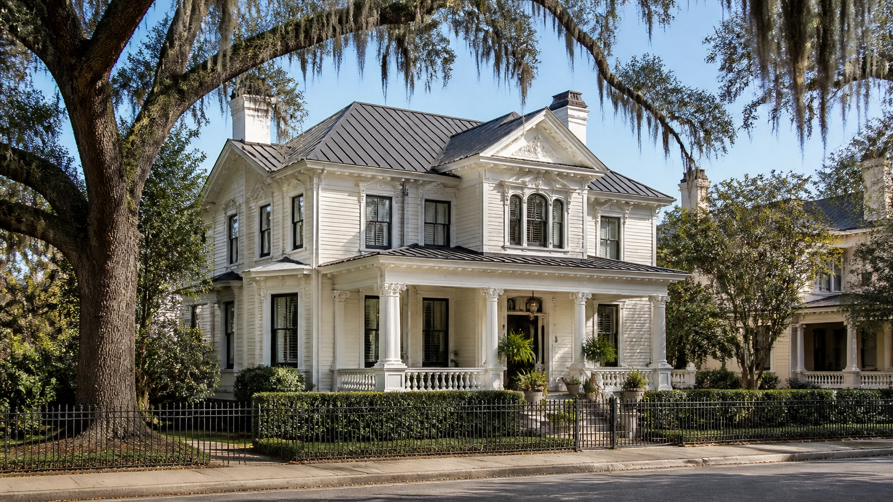
    Renovated historic Southern colonial home in Savannah with clean architectural shingle rooflines

    One of Savannah’s greatest assets is its architectural heritage. However, inspecting and replacing roofs on fragile historic structures presents significant engineering challenges.

    Traditional in-person inspections can risk damaging aging slate tiles, fragile clay elements, or historic timber framing. Satellite and aerial imaging offer a non-invasive alternative that preserves structural integrity while accelerating project planning.

    Balancing Authenticity and Modern Durability

    Historic preservation boards require replacement materials to match the visual profile of the original construction. Homeowners typically evaluate three main tiers of materials:

    1. Architectural Asphalt Shingles (Popular): Cost-effective, rated for high wind resistance, and available in profiles that mimic traditional slate or wood shakes while meeting modern building codes.
    2. Standing-Seam Metal (Premium): Highly durable against salt air and hurricane-force winds, offering a sleek look that complements historic industrial and modern coastal architecture alike.
    3. Synthetic Slate and Tile (Specialty): Engineered to replicate historic materials precisely while weighing a fraction of natural stone, reducing strain on older framing.

    By coupling high-resolution satellite measurements with expert local knowledge, homeowners can submit accurate documentation to preservation boards faster and with greater confidence.


    Streamlining Your Savannah Roof Replacement Project

    When planning a roof replacement in coastal Georgia, efficiency and transparency are paramount. Leveraging instant digital tools transforms a traditionally stressful chore into a streamlined, predictable process.

    Residential roof replacement in progress on a coastal Georgia home with heavy-duty shingles

    Step-by-Step Modern Workflow

    • Step 1: Get Instant Data: Visit Get My Roof Estimate Now and input your Savannah address to receive an immediate low-middle-high price range based on your exact roof size and pitch.
    • Step 2: Review Material Options: Evaluate your budget against local material benchmarks: whether opting for durable architectural shingles (Budget/Popular) or wind-resistant standing-seam metal (Premium).
    • Step 3: Connect With Verified Pros: Get matched with licensed, insured local contractors who specialize in Savannah's specific climate demands and historic district standards.

    By utilizing satellite-powered estimating, homeowners eliminate the guesswork, protect their historic investments, and secure transparent pricing in under a minute.

  • Daily Weather Blitz – Slot 3: Birmingham, AL : August 8, 2026: 92°F Heat, Scattered Storms & How Alabama’s Summer Climate Tests Your Roof

    Daily Weather Blitz – Slot 3: Birmingham, AL : August 8, 2026: 92°F Heat, Scattered Storms & How Alabama’s Summer Climate Tests Your Roof

    As August reaches its peak, Central Alabama’s summer climate continues to push residential and commercial building materials to their absolute limits. Today in Birmingham, AL, homeowners face a sweltering high of 92°F, with a punishing heat index soaring up to 103°F. Compounding this intense solar radiation, widely scattered afternoon thunderstorms are forecasted from noon through early evening, bringing heavy downpours, frequent lightning, and isolated flooding risks across Jefferson and Shelby counties.

    For property managers and homeowners, days like today are a stark reminder of what roof systems endure in the Deep South. Between blistering surface temperatures and sudden, violent downpours, Alabama weather acts as a relentless stress test for roofing components.

    Understanding how local climate factors impact your roof: and knowing how to fortify it: is critical for preventing premature failure and expensive emergency repairs.


    The Central Alabama Climate Test: Heat, Humidity, and Thermal Cycling

    Roofing systems in Birmingham do not simply age from normal wear and tear; they are actively baked, warped, and weathered by extreme environmental forces year-round, with summer being the most punishing season.

    Close-up architectural photograph of a durable standing seam metal roof on a modern home in the American South

    1. Extreme Surface Temperatures and UV Degradation

    While ambient air temperatures reach 92°F today, standard dark asphalt shingles under direct southern sunlight routinely absorb heat, pushing roof surface temperatures between 150°F and 170°F.

    • The Impact: This prolonged thermal stress bakes the volatile oils out of asphalt shingles, causing them to dry out, curl, blister, and shed protective mineral granules prematurely. Once granule loss occurs, the fiberglass mat underneath is directly exposed to UV radiation, accelerating degradation.

    2. Thermal Cycling and Material Fatigue

    Birmingham's dramatic day-to-night temperature swings: often 20°F to 25°F in summer: cause building materials to expand during peak heat and contract sharply as evening storms roll in.

    • The Impact: This constant daily movement (thermal cycling) exerts immense mechanical stress on fasteners, roof decking, flashing seams, and sealants. Over time, it leads to fastener back-out, cracked flashing, and split seams where water can easily infiltrate during heavy rain.

    3. High Humidity and Biological Growth

    Central Alabama averages sustained high humidity levels above 70%, creating a humid microclimate right on your roof surface.

    • The Impact: Moisture retention in shaded roof valleys promotes aggressive growth of algae (such as Gloeocapsa magma, visible as dark streaks), moss, and lichen. These organisms hold moisture against the shingle surface, rotting organic components and eroding protective granules.

    Surviving Storm Season: Lightning, Downpours, and Wind Stress

    Today's forecast highlights widely scattered thunderstorms capable of producing torrential rainfall and localized flooding from noon to early evening. In a matter of minutes, a calm 92°F afternoon can transform into a high-intensity localized weather event.

    Charming southern ranch-style home with an upgraded algae-resistant shingle roof and warm summer afternoon lighting

    • Driving Rain and Wind Shear: Sudden gusty winds lift shingle tabs, allowing driving rain to bypass secondary underlayment layers and leak into attic spaces.
    • Flashing Vulnerability: Valleys, chimneys, plumbing boots, and skylights bear the brunt of thermal movement and heavy water volume. When sealants fail around these penetrations, interior water stains on ceilings are often the first sign of trouble.
    • Lightning and Electrical Surges: While rare for lightning to structurally demolish a roof, direct strikes can shatter masonry chimneys and damage roof-mounted electrical service masts or solar equipment.

    Best Roofing Materials for Central Alabama’s Climate

    If your roof is approaching the 15-to-20-year mark, or if you are planning a replacement to combat Alabama’s punishing climate, material selection is everything. Upgrading to climate-resilient products dramatically extends your roof's lifespan.

    1. Class 4 Impact-Resistant Shingles (Popular)

    • Why it fits Birmingham: Engineered with advanced polymer-modified asphalt or heavy-duty fiberglass reinforcement, Class 4 shingles withstand high winds, debris impact, and severe thermal shock far better than standard 3-tab or basic architectural shingles. Many insurance providers in Alabama also offer annual policy discounts for homes equipped with Class 4 roofs.

    2. Standing Seam Metal Roofing (Premium)

    • Why it fits Birmingham: Metal roofs reflect solar radiant heat far more effectively than asphalt, reducing attic cooling loads by up to 25%. Furthermore, concealed fastener standing seam systems expand and contract seamlessly during thermal cycling and boast superior wind resistance, frequently rated for gusts exceeding 140 mph.

    3. Optimized Attic Ventilation (Essential)

    • Why it fits Birmingham: No matter the shingle type, trapped attic heat will destroy a roof from the inside out. A balanced ventilation system combining continuous soffit intake vents and high-volume ridge exhaust vents keeps attic temperatures stabilized, preventing premature shingle baking and lowering indoor cooling bills.

    Actionable Maintenance Tips for Birmingham Homeowners

    To keep your roof resilient against today’s heat index and upcoming storm cycles, incorporate these practical maintenance checks into your seasonal routine:

    Professional roofing technician conducting a rooftop inspection on a residential home in the Southeast during summer

    • Post-Storm Visual Checks: After heavy afternoon thunderstorms pass, walk the perimeter of your property with binoculars. Look for missing shingle tabs, granules collecting in gutter downspouts, or bent metal flashing.
    • Inspect Attic Airflow: Visit your attic during the warmest part of the day. If the space feels like an oven or smells stagnant, your intake or exhaust ventilation is likely insufficient, requiring immediate remediation.
    • Watch for Algae Streaking: If you notice dark stains or green moss patches, clean them gently with a low-pressure, shingle-safe washing solution to prevent root penetration and moisture retention.
    • Schedule Professional Evaluations: Have a certified professional evaluate your roof annually: especially after major seasonal hail or wind events. For quick preliminary budgeting without waiting days for a contractor visit, you can explore digital tools like our roof cost calculator to estimate project pricing instantly.

    Eliminate the Guesswork: Instant Satellite Roof Estimates Without the Wait

    Planning a roof replacement in Birmingham shouldn't require rearranging your schedule to wait weeks for multiple contractor sales pitches.

    High-end residential colonial brick home with a newly installed Class 4 impact-resistant shingle roof under a clear blue sky

    At Get My Roof Estimate Now, we leverage advanced satellite imagery technology to measure your roof down to the inch with 90–95% accuracy: completely free and with zero credit card required.

    Within 60 seconds of entering your address, you receive a transparent, data-driven breakdown of your roof's square footage, material options (including architectural shingles, metal, and coatings), and realistic low-middle-high price ranges tailored for Central Alabama.

    Don't let another summer storm catch you off guard. Visit Get My Roof Estimate Now today to take control of your home's protection with lightning-fast, transparent pricing.


  • Daily FAQ Blitz – Slot 3: Satellite Roof FAQ Quick Answers for Grand Rapids, MI Homeowners (2026)

    Daily FAQ Blitz – Slot 3: Satellite Roof FAQ Quick Answers for Grand Rapids, MI Homeowners (2026)

    Navigating a roof replacement in Grand Rapids, Michigan can feel overwhelming. Between unpredictable Midwest weather, fluctuating material costs, and the hassle of scheduling traditional contractor walkthroughs, homeowners need fast, reliable answers. That is why modern technology has transformed how property owners plan their home improvements.

    Using advanced satellite imagery technology, homeowners can now secure precise, instant roof replacement cost estimates in under 60 seconds: without ever needing a sales rep to climb your ladder.

    Below is our Daily FAQ Blitz addressing the most common questions Grand Rapids homeowners are asking in 2026 regarding satellite roof measurements, local replacement costs, and what to expect during your next roofing project.


    What Do 2026 Roof Replacement Costs Look Like in Grand Rapids, MI?

    Before diving into specific questions, let's establish the financial baseline. For a typical 2,000 to 2,200 square foot single-family home in Grand Rapids in 2026, a standard roof replacement featuring architectural asphalt shingles generally ranges between $11,000 and $18,000, with most mid-range projects landing comfortably around $12,000 to $16,000.

    Close-up of architectural asphalt shingles


    Frequently Asked Questions

    1. How Accurate Are Satellite Roof Measurements Compared to Manual Roof Inspections?

    (Accuracy: 90%–95%)

    Satellite-powered roof measurement tools utilize high-resolution aerial imagery and pitch-detection algorithms to map your home's exact dimensions.

    • Precision: Measurements are accurate to within inches, capturing total surface area, ridge lengths, valleys, and eaves.
    • Speed: Instead of waiting days for a roofing contractor to visit your property, satellite technology calculates your roof squares in under a minute.
    • Reliability: While satellite estimates provide a dependable 90%–95% dimensional accuracy for budgeting and material calculation, final contractor quotes may adjust slightly once hidden factors like rotted decking are uncovered on-site.

    To check your roof's measurements instantly, try our Free Roof Cost Calculator.

    2. What Is the Average Cost per Square Foot for Roofing Materials in Grand Rapids?

    When evaluating estimates, understanding per-square-foot pricing helps you compare material tiers effectively:

    • 3-Tab Asphalt Shingles (Budget): $3.00 – $4.50 per square foot installed. Cost-effective upfront, but with a shorter lifespan (15–20 years).
    • Architectural Asphalt Shingles (Popular): $3.50 – $6.75 per square foot installed. Highly durable, dimensional look, and built to withstand Michigan winter snow loads.
    • Standing Seam Metal Roofing (Premium): $8.00 – $14.00+ per square foot installed. Exceptionally long-lasting (40+ years) and highly resistant to severe winds and ice damming.

    Colonial style home with metal roof

    3. Do I Need to Schedule a Contractor Visit to Get an Initial Estimate?

    (Convenience: Zero Upfront Visits)

    No. Traditional roofing estimates required clearing your schedule for a 2-hour in-home sales presentation just to get a ballpark figure.

    • Instant Access: With our satellite estimation platform, you simply enter your Grand Rapids home address on Get My Roof Estimate Now.
    • No Pressure: You receive an immediate breakdown of low, middle, and high price ranges based on local labor rates and roof complexity.
    • Verified Connections: Once you have your budget in hand, we can connect you with licensed, insured, and verified local contractors when you are ready to move forward.

    4. How Do Grand Rapids Winter Weather and Ice Dams Affect Roof Replacement Timing?

    Michigan winters bring heavy snowfall, freezing temperatures, and ice dam potential.

    • Timing: While emergency tarping and repairs happen year-round, full roof replacements are ideally scheduled from late spring through early autumn when temperatures allow proper shingle sealing.
    • Materials Matter: If your roof suffers from chronic ice damming, upgrading your attic ventilation and installing high-performance ice and water shield underlayment: factored into your satellite estimate: prevents future interior leaks.

    Homeowner reviewing satellite roof measurements

    5. What Hidden Costs Should Grand Rapids Homeowners Budget For?

    Transparency is vital when planning home improvements. While satellite tools give you precise baseline numbers, always keep a 10% to 15% contingency fund in mind for:

    • Decking Replacement: Rotted or water-damaged plywood decking found after old shingles are torn off.
    • Permit Fees: Local municipal building permits required in Kent County and Grand Rapids.
    • Chimney Flashing: Upgrading old rusted metal flashing around chimneys and skylights.

    Why Grand Rapids Homeowners Choose Satellite-Powered Estimates

    Modern homeowners value efficiency, data transparency, and time-saving technology. By leveraging satellite imagery, you eliminate guesswork, avoid high-pressure sales tactics, and take full control of your home improvement budget before ever speaking to a contractor.

    Explore more expert guides and cost breakdowns on our Blog.


    Have More Questions or Ready for Your Free Estimate?

    Every roof is unique, and getting customized pricing shouldn't be a hassle. Whether you want to dive deeper into material comparisons or need a tailored estimate for your specific Grand Rapids zip code, we are here to help.

    Get your instant, free roof replacement cost estimate in under 60 seconds today at Get My Roof Estimate Now.


  • Daily Weather Blitz – Louisville, KY : August 8, 2026: 92°F Heat, Scattered Storms & How Kentucky’s Ohio Valley Climate Affects Your Roof

    Daily Weather Blitz – Louisville, KY : August 8, 2026: 92°F Heat, Scattered Storms & How Kentucky’s Ohio Valley Climate Affects Your Roof

    As Louisville hits a sweltering 92°F this Saturday afternoon, August 8, 2026, homeowners across Jefferson County and the greater Ohio Valley are cranking up their air conditioners while keeping a wary eye on the horizon. Scattered afternoon storm cells are beginning to brew, bringing sudden downpours, high humidity, and gusty winds. While a passing summer shower offers a brief respite from the heat, it serves as a stark reminder of the relentless environmental pressures facing Louisville roofs.

    Operating in Kentucky's dynamic Ohio Valley climate means your roofing system is subjected to a punishing weather cycle: intense summer heat and humidity, severe spring thunderstorms, and fluctuating winter freeze-thaw episodes. Understanding how these local weather patterns impact your shingles, decking, and flashing is essential for protecting your home's equity.

    In this breakdown, we examine current Louisville weather conditions, analyze regional roofing costs and material choices, explore how a satellite roof inspection streamlines project planning, and provide actionable storm resilience tips tailored for Kentucky homeowners.


    Louisville’s Climate Challenge: Why Ohio Valley Weather Tests Your Roof

    Louisville’s position in the humid subtropical and moist-continental transition zone creates unique architectural stresses. With roughly 44 to 48 inches of annual rainfall and over 115 precipitation days per year, roofs here never truly catch a break.

    1. Thermal Stress and High Humidity (90°F+ Days)

    Summers in Louisville routinely bring prolonged heatwaves with dozens of days pushing past 90°F. When ambient air hits 92°F, dark asphalt roof surfaces can easily reach temperatures exceeding 150°F. Combined with high relative humidity, this extreme heat accelerates the degradation of asphalt shingle granules, dries out protective sealants, and bakes underlying decking. Without proper attic ventilation, trapped heat warps structural rafters and shortens the lifespan of your roof replacement investment.

    2. Sudden Storm Cells and High Winds

    Ohio Valley summer afternoons are famous for pop-up thunderstorms packing torrential downpours and strong straight-line winds. These microbursts test the uplift resistance of ridge caps, edge metal, and starter strips. When fasteners give way under sudden wind loads, water infiltrates the underlayment, leading to interior ceiling stains and structural rot long before homeowners notice missing shingles from the ground.

    3. Winter Freeze-Thaw Cycles

    While summer heat dominates today's forecast, Louisville winters introduce average low temperatures in the mid-20s°F alongside occasional ice and snow events. Water trapped in microscopic cracks freezes and expands, progressively splitting shingle edges, masonry chimney crowns, and flashing joints.


    Material Breakdown & Estimated Replacement Costs in Louisville

    Choosing the right roofing material for Kentucky's climate requires balancing upfront investment against long-term durability. Below is a breakdown of current 2026 material tiers for an average 2,000-square-foot Louisville roof:

    Professional roofing contractor performing a satellite roof inspection using a tablet on a modern single-family home roof

    • Architectural Asphalt Shingles (Popular): The most common choice across Jefferson County. Rated for 30–50 years with algae-resistant granules suited for humid summers.
      • Estimated Cost Range: $9,500 – $14,000 installed.
    • Standing Seam Metal Roofing (Premium): Exceptional wind uplift resistance (up to 140 mph) and superior solar reflectivity, shedding summer heat effectively while shrugging off heavy ice and snow.
      • Estimated Cost Range: $18,000 – $28,000 installed.
    • Synthetic Slate & Composite Tiles (Luxury): Mimics natural slate without the massive structural weight, offering elite durability against storm debris and severe hail impact.
      • Estimated Cost Range: $25,000 – $40,000+ installed.
    • 3-Tab Asphalt Shingles (Budget): Entry-level protection with lower wind warranties (typically up to 60 mph), making them less ideal for storm-prone Ohio Valley regions.
      • Estimated Cost Range: $7,500 – $10,500 installed.

    For homeowners comparing regional price variations across the Southeast and Gulf Coast: such as reviewing a 2026 Roof Replacement Cost Mobile AL: it's clear that material logistics, local labor rates, and regional building code wind ratings heavily influence final project estimates.


    Streamlining Your Project with Satellite Roof Inspection Technology

    Traditionally, getting a roof estimate meant waiting days for a local contractor to climb a ladder, measure manually with a tape, and deliver a high-pressure sales pitch. Today, advanced property technology has revolutionized how homeowners plan exterior renovations.

    Utilizing high-resolution orbital imagery and AI-powered measurement algorithms, a satellite roof inspection generates precise blueprints accurate to within inches in under 60 seconds. This modern methodology measures total surface area, pitch, valleys, hips, and penetrations instantly without anyone ever setting foot on your shingles.

    By visiting our interactive roof cost calculator, Louisville homeowners can input their exact street address, select their preferred shingle or metal tier, and receive a comprehensive, transparent price range instantly: completely free and with no credit card required.


    Practical Storm Resilience Tips for Kentucky Homeowners

    With scattered storms threatening the Louisville area this weekend and throughout the humid season, proactive maintenance is your best defense against costly emergency repairs. Implement these expert storm resilience tips to safeguard your property:

    Modern ranch-style home in Kentucky with a sleek metal roof under dramatic scattered storm clouds

    • Inspect Your Attic Ventilation: Ensure ridge vents and soffit vents are unblocked. Proper airflow lowers roof deck temperatures during 90°F+ heatwaves and prevents moisture accumulation that causes premature wood rot.
    • Secure Roof Penetrations: Check the rubber boots around plumbing vent stacks and flashing around chimneys. These are the most common entry points for wind-driven rain during summer thunderstorms.
    • Keep Gutters Clear: Ohio Valley trees drop heavy debris in spring and summer. Clean gutters and downspouts ensure that torrential downpours drain safely away from your home's foundation rather than backing up under your roof eaves.
    • Trim Overhanging Tree Limbs: Heavy gusty winds easily snap weak branches. Keeping mature trees trimmed away from your roofline prevents punctures and impact damage during severe weather outbreaks.
    • Schedule Professional Evaluations After Major Storms: If severe winds or localized hail sweep through your neighborhood, avoid door-to-door storm chasers. Instead, rely on verified, licensed local contractors to perform a thorough, honest post-storm assessment.

    Plan Ahead with Confidence

    Navigating Louisville's unpredictable weather doesn't have to be stressful. Whether your roof is nearing the 20-year mark, you've noticed granule loss in your gutters, or you are simply budgeting for future home improvements, having accurate data puts you in control.

    Suburban American home with premium synthetic slate roofing tiles and manicured landscaping under bright summer daylight

    Skip the scheduling delays and guesswork. Get your instant, satellite-powered roof estimate today at Get My Roof Estimate Now and connect with trusted local professionals who understand the unique demands of Kentucky's Ohio Valley climate.