The skyline of Durham, North Carolina, has long been defined by its historic tobacco warehouses and the Gothic spires of Duke University. But today, the most significant developments in the Research Triangle aren't happening on the ground: they are happening 300 miles up in Low Earth Orbit (LEO).
Satellite technology is no longer just for global positioning or military intelligence. It has officially arrived on your driveway. From Duke-born startups securing millions in funding to the very tool you use to price out your next home improvement project, orbital technology is reshaping the North Carolina housing market.
At Get My Roof Estimate Now, we’ve integrated this "space-to-shingle" pipeline to provide homeowners with instant, accurate data. But to understand why your next roof estimate is faster than a trip to the grocery store, you have to look at the massive tech shift happening right here in Durham.
The Extellis Breakthrough: Durham’s New Eye in the Sky
Just yesterday, on July 23, 2026, the local tech scene reached a new milestone. Extellis, a high-growth startup born out of Duke University’s engineering labs, confirmed it has secured over $7 million in funding (Seed Round Extension). With backing from industry heavyweights like Shell Ventures and Oval Park Capital, Extellis is preparing for its "Pathfinder" mission.
What makes this Durham startup unique? They aren't just taking pictures; they are perfecting Synthetic Aperture Radar (SAR) using metamaterial antennas (Advanced Tech). Unlike traditional satellite cameras that need sunlight and clear skies, SAR can "see" through heavy North Carolina humidity, thick cloud cover, and total darkness.
For homeowners, this means data is becoming "all-weather." When a storm rolls through the Triangle, the next generation of satellites won't have to wait for the clouds to clear to assess regional damage. This tech is moving toward a world where a satellite can capture up to 10,000 high-resolution images a day, providing real-time snapshots of every roof in the zip code.
The "Satellite Edge" in Your Backyard
While Extellis builds the hardware, the practical impact is already hitting North Carolina property owners. If you live in Raleigh, Durham, or Chapel Hill, your roof is likely already being monitored from space.
1. Insurance Transparency and Regulation
North Carolina regulators have recently taken a firm stand on how this tech is used. According to the NC Department of Insurance Bulletin 25-B-09, insurance companies are now restricted from using satellite or drone imagery as the sole reason for cancelling a policy.
Insurers must now:
- Provide a "precise reason" for nonrenewal based on the imagery (Transparency).
- Allow homeowners a meaningful chance to dispute the findings (Fairness).
- Verify aerial data with physical inspections if the imagery is ambiguous or outdated (Accuracy).
This regulation is a win for homeowners. It prevents "algorithmic cancellations" while still allowing for the legitimate use of tech to identify high-risk areas before a disaster strikes.
2. Instant Roofing Estimates
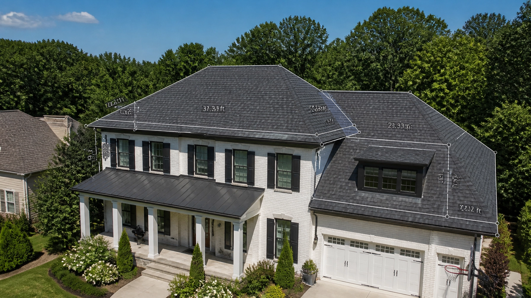
This is where the tech becomes a tool for the consumer. At Get My Roof Estimate Now, we utilize high-resolution satellite imagery to bypass the traditional, slow process of contractor visits.
Instead of waiting days for a local roofer to bring a ladder to your house, our roof cost calculator uses satellite measurements (90-95% Accuracy) to calculate your roof's "squares," pitch, and complexity in under 60 seconds.

Beyond Durham: The 2026 Global Satellite Blitz
The innovation we see in the Triangle is part of a broader "Satellite Tech Edge" occurring this summer. Two major milestones in July 2026 have pushed the boundaries of what these machines can do:
- NASA’s Gemma 3 Integration: NASA has successfully deployed the Gemma 3 vision-language model (AI-Powered) on the YAM-9 satellite. This allows satellites to not only take photos but to "understand" them. A satellite can now identify specific types of roof damage or structural anomalies and send back a text summary rather than a massive data file.
- Northrop Grumman’s Robotic Servicing: This month, Northrop Grumman launched its latest robotic servicing satellite. Its mission? To dock with aging satellites and extend their life. This "orbital repair shop" ensures that the satellite networks we rely on for home estimates and weather tracking stay functional for decades, reducing space debris and costs for everyone.
Why Satellite Measurements Beat the Tape Measure
For the average homeowner in Durham or Raleigh, "metamaterials" and "robotic servicing" might sound like science fiction. But the results are very grounded. Here is why satellite-powered estimates are the new standard for the industry:
| Feature | Traditional Estimate | Satellite Estimate (Get My Roof Estimate Now) |
|---|---|---|
| Wait Time | 3–7 Days | < 60 Seconds |
| Accuracy | Subjective / Human Error | Inches-Accurate (90-95%) |
| Cost | Free (but requires a sales pitch) | $0 (No credit card required) |
| Safety | Requires someone on your roof | Zero-contact / Remote |
| Convenience | Must be home for the visit | 100% Online |

Understanding the Factors
When we use satellite tech to measure your home, we factor in several technical variables:
- The "Square": Roofs are measured in 10×10 foot areas. A typical 2,500 sq. ft. home in Durham usually has a roof between 25 and 35 "squares" depending on the pitch.
- The Pitch (Steepness): Satellites calculate the angle of your roof. Steeper roofs require more safety equipment and labor, which our tool factors into the final price range.
- Waste Factor: We automatically calculate the extra 10-15% of material needed for hips, valleys, and ridges (Waste).
Material Matters: What the Tech Sees
The "eye in the sky" also helps categorize what kind of replacement you need. Whether you are looking for a Budget option or a Premium lifetime solution, the satellite data helps us match the right materials to your home’s architecture.
- Architectural Shingles (Popular): The most common choice in North Carolina. They offer a great balance of durability (30+ years) and cost.
- Metal Roofing (Premium): Increasingly popular in the rural areas surrounding the Triangle. These roofs can last 50+ years and are highly resistant to the heavy wind and hail we see in the Southeast.
- Synthetic & Slate (Luxury): Satellite imaging is particularly good at identifying the complex rooflines where these heavier, more expensive materials are often used.

Action Steps for Durham Homeowners
If your roof is between 15 and 30 years old, or if you’ve recently experienced one of North Carolina’s frequent summer storms, you don't need to wait for a contractor to find out where you stand financially.
The tech developed by companies like Extellis and utilized by platforms like ours is designed to give power back to the homeowner. By knowing your numbers before you ever speak to a contractor, you eliminate the pressure and the "sales fluff."
Ready to see the tech in action?
Enter your address into our instant roof estimate tool and get your comprehensive pricing report in under a minute. No ladders, no waiting, just the data you need to protect your home.
Whether you're in a ranch-style home in South Durham or a colonial in North Raleigh, the "Satellite Tech Edge" is working for you. The future of home maintenance isn't just on your roof; it's in the stars.
Leave a Reply